
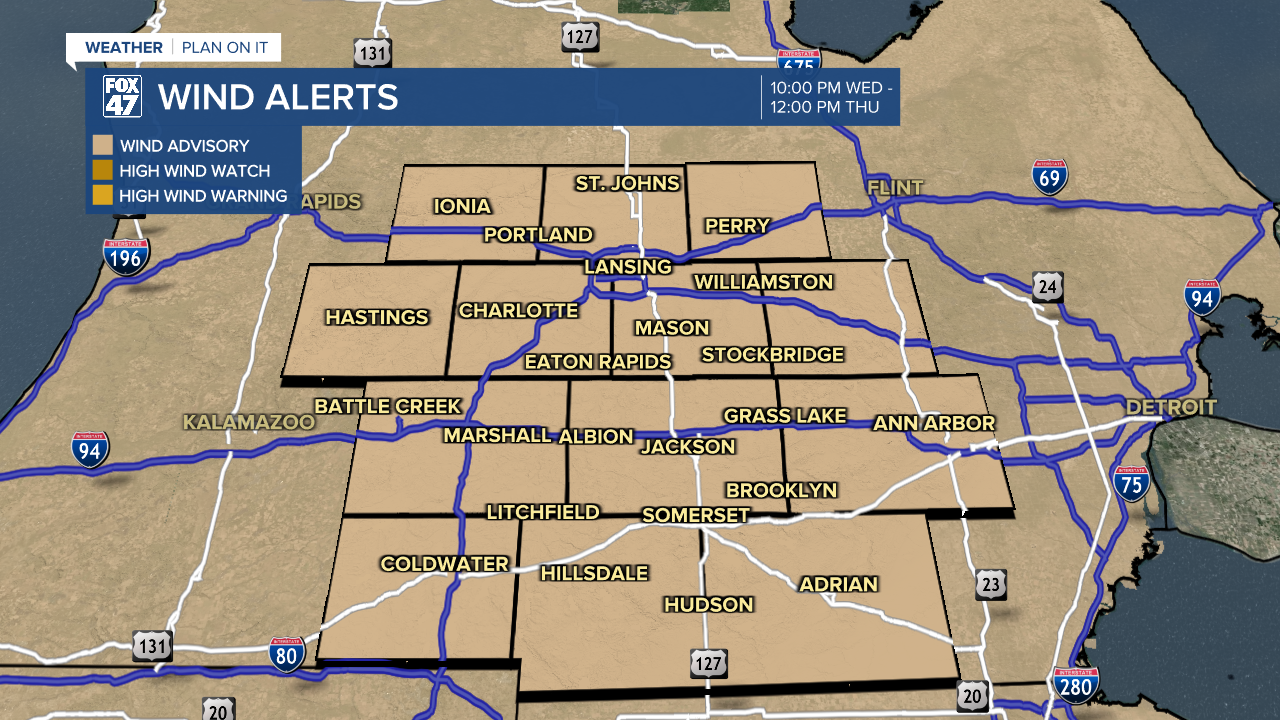
LANSING, Mich. — A Wind Advisory has been issued for the entire Fox 47 viewing area from 10:00 PM tonight until Noon Thursday. Northwesterly winds will increase to 20-30 mph, with gusts as high as 45 mph possible. Use extra caution on the roads if you drive a high-profile vehicle.
Scattered showers will continue this evening as low pressure tracks across the state. Some of the showers could produce brief, heavy downpours or even a few rumbles of thunder so use caution on the roads.
This will be especially true if you plan on being out late into this evening as colder air begins to pour in from the west. Temperatures will quickly start to decline into the 40s and 30s after sunset, eventually changing lingering rain into mixed rain & snow showers by midnight.

A full changeover to scattered snow showers will take place from there, continuing into early Thursday morning as lows dip into the middle and upper 20s. The falling temperatures could allow a brief coating of snow to develop on grassy and elevated surfaces, and wet surfaces could freeze over, too. Stay alert and watch your step when heading out in the morning.

A final point of concern for tonight will be increasing winds in the wake of Wednesday's storm system. Winds pivoting to the northwest will increase to 20-30 mph across our neighborhoods, with gusts up to 45 mph possible. Take some time this evening to secure any loose objects around your home to prevent them from blowing away!

A few leftover snow showers will remain possible until about mid-morning on Thursday, giving way to mostly cloudy skies through lunchtime. Skies will begin to clear in the afternoon as high pressure to our south briefly wedges its way in over the Great Lakes. Even with the returning sunshine though, highs will be held to just the mid 30s, marking a stark contrast to the past couple of days.

Friday continues to hold the chance for a few snow showers, especially for our southernmost neighborhoods. This as a small disturbance tracks across northern Indiana and Ohio. Some uncertainty still exits around the exact track for the system, and even a slight northerly shift could mean a snowier Friday for many of us. Stay tuned for updates.
Want to learn more about the Weather? Visit the FOX47News Website.
Stay in touch with us anytime, anywhere.
Sign up for newsletters emailed to your inbox.
Select from these options: Breaking News, Severe Weather, School Closings, Daily Headlines and Daily Forecasts.
