
LANSING, Mich. — High temperatures today will range in the mid to upper 20's which is a bit below average for this time of year. We will start to gradually warm up again beginning tomorrow ahead of the wintry mix that we are tracking.
We are looking to stay dry through the day today and through the daytime hours of tomorrow before the wintry mix arrives in the late evening hour around 10-11pm. This wintry mix will last through Thursday morning as neighborhoods along and south of I-96 could see ice accumulations.
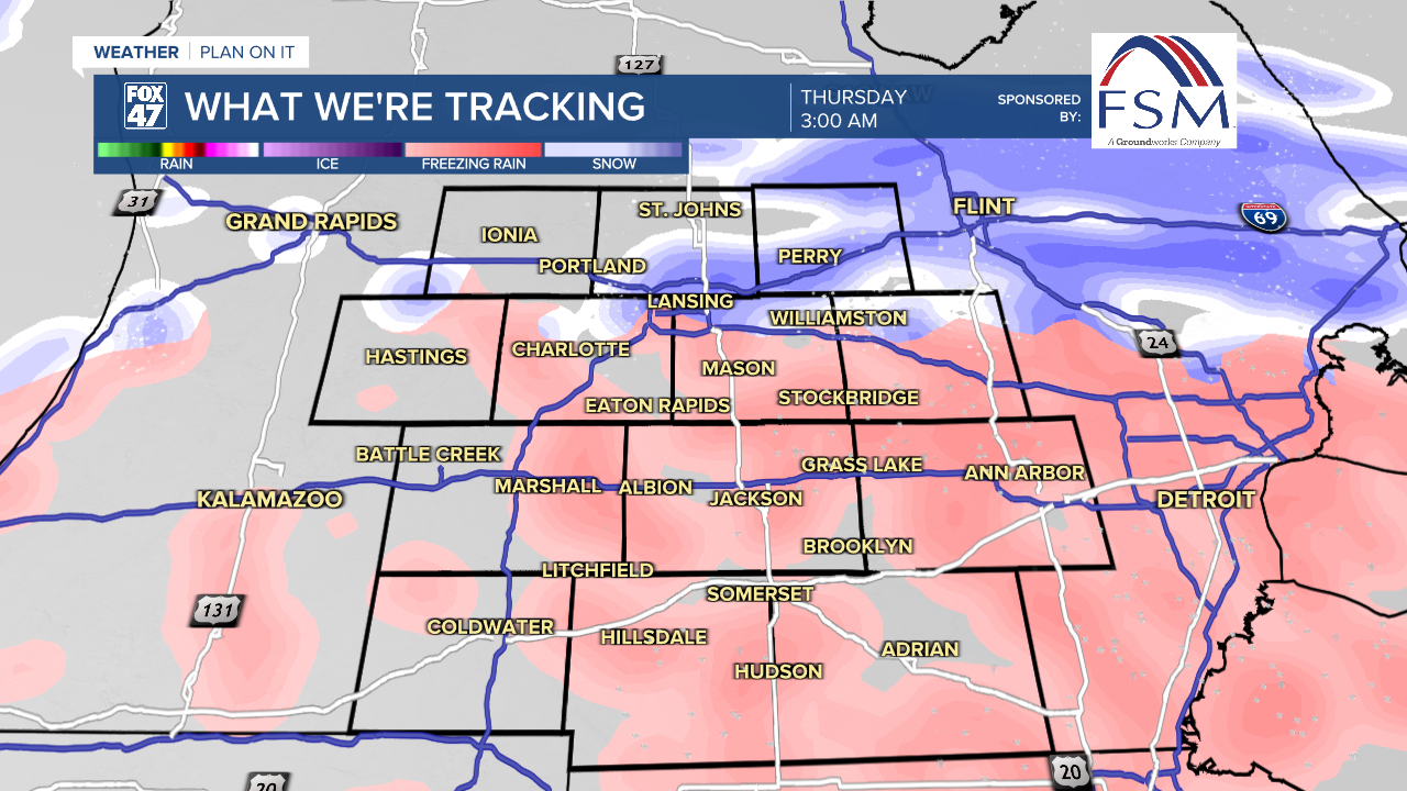
Southern neighborhoods including Jackson and Hillsdale could see over .10" of ice accumulation by Thursday morning. Eaton and Ingham counties could see up to .10" of ice accumulation. Clinton county is looking to see a chance for mixed precipitation, but mostly snowfall at around an inch or two possible. We will continue to monitor for any changes.

There is a similar setup for this weekend that could drive more mixed precipitation into our neighborhoods. We will continue to keep you updated with the evolution of that system as well as any changes for Wednesday night into Thursday morning.
Want to learn more about the Weather? Visit the FOX47News Website.
Stay in touch with us anytime, anywhere.
Sign up for newsletters emailed to your inbox.
Select from these options: Breaking News, Severe Weather, School Closings, Daily Headlines and Daily Forecasts.
