
LANSING, Mich. — A Frost Advisory is in effect from 2:00 AM until 8:00 AM Wednesday for neighborhoods along and north of I-94.
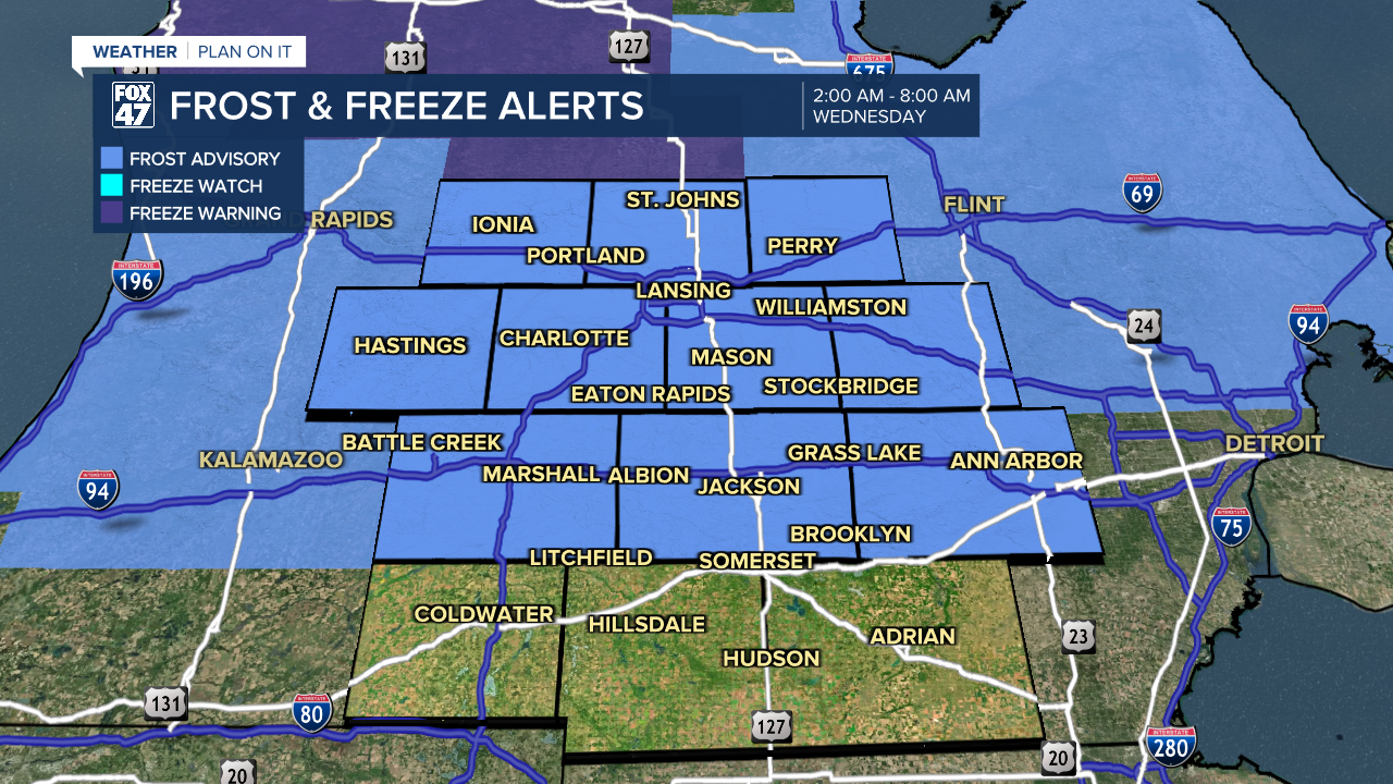
After a day that saw highs climb into the low 80s along with strong winds and a few thunderstorms, we bracing for a steep dip in the temperatures tonight and the threat of frost. The passing cold front will allow a brief shot of chilly air to spill south across Michigan, leading to clearing skies will temperatures take a dive into the low and mid 30s. With winds diminishing, areas of frost are expected to develop across our neighborhoods by daybreak. Make sure to protect any sensitive plants you may have outdoors by either bringing them inside for the night or covering them up!
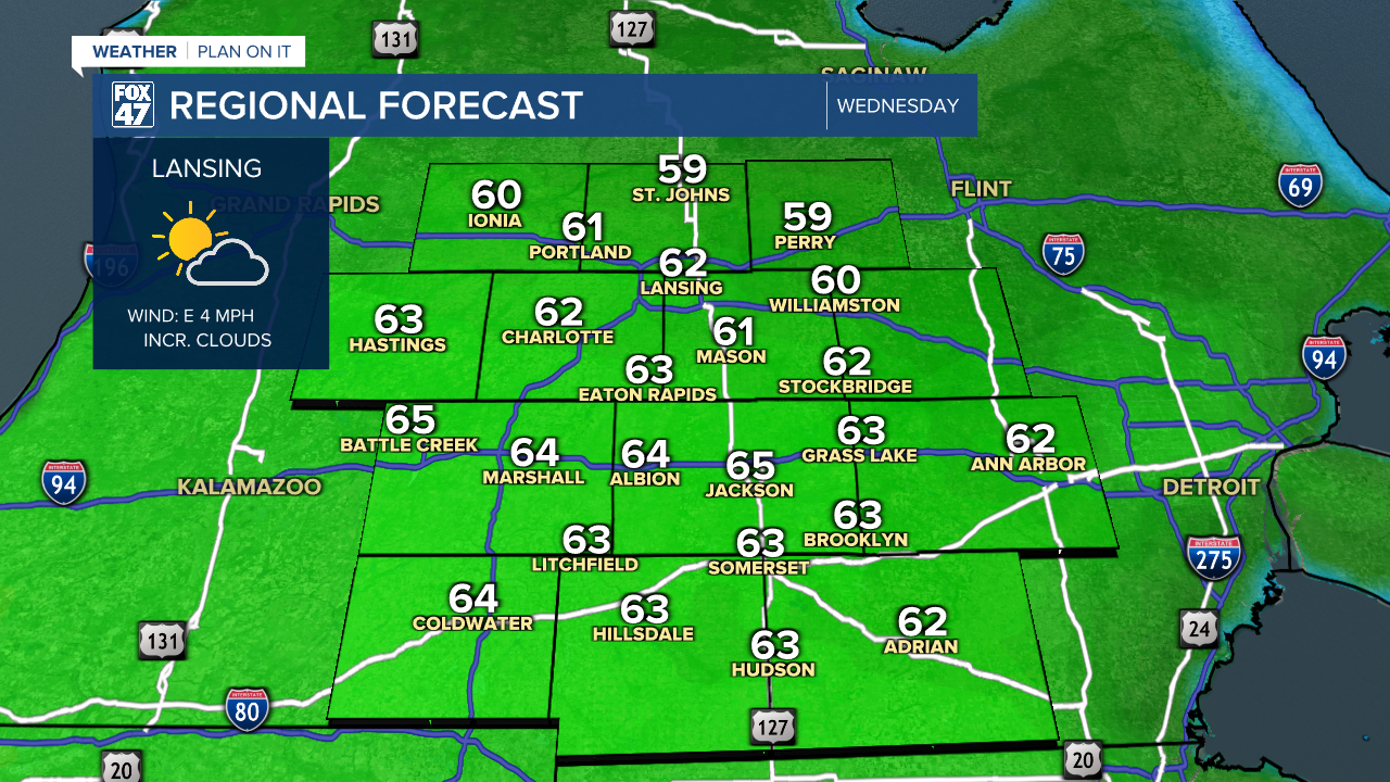
We'll shake off the cold start pretty well on Wednesday. Mostly sunny skies in the morning will give way to a gradual increase in clouds during the afternoon. Highs will make their way back to around average in the low 60s, so it should still be plenty nice to get outside.
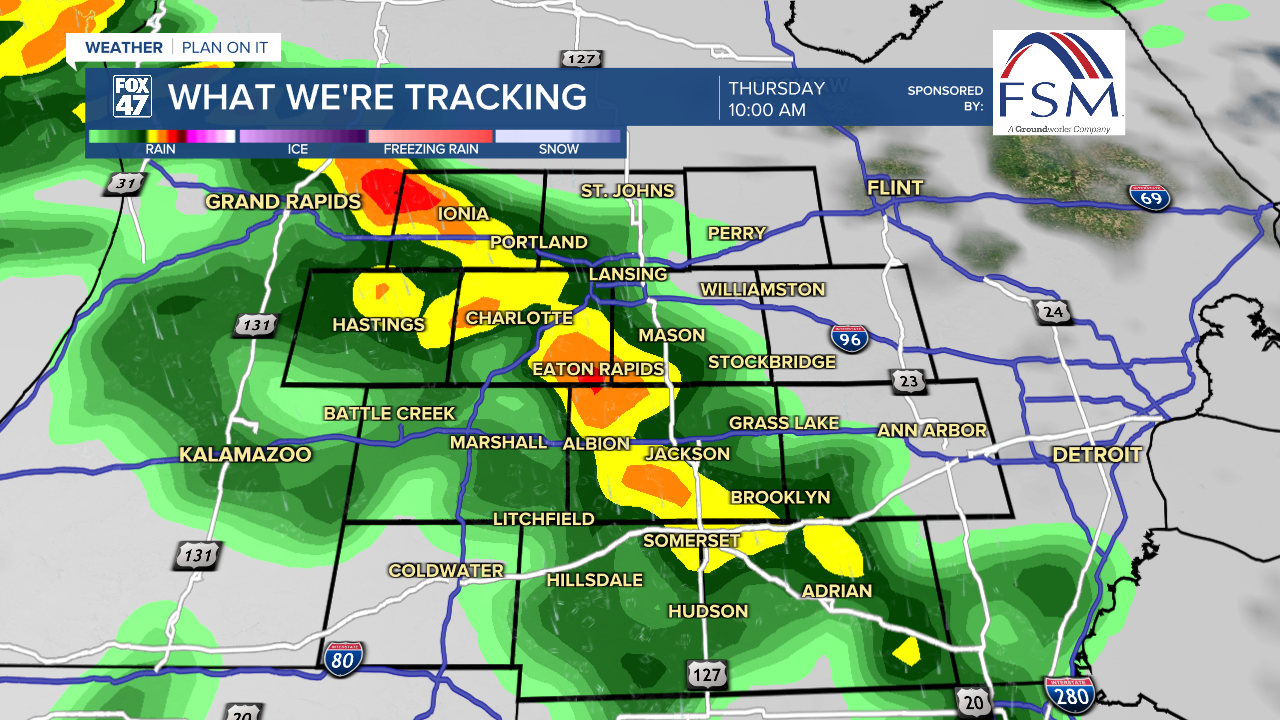
A new storm system moving into the Great Lakes will bring some spotty showers back to the area late Wednesday night, setting up a soggy morning commute on Thursday for some neighborhoods. Showers will become more widespread throughout the day on Thursday, possibly accompanied by a few rumbles of thunder. Highs will make their way back to the upper 60s for the day, before the system ushers in another cooldown to take us into the start of the weekend.
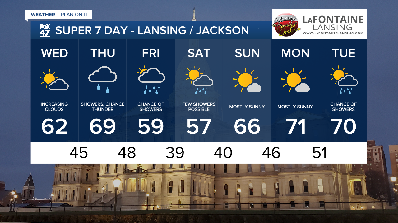
Leftover showers will be possible on Friday with mostly cloudy skies, but highs are going to wind up back in the upper 50s. We'll stay at similar levels on Saturday with another chance for a shower before sunshine returns and warms us back to the mid 60s on Sunday.
Want to learn more about the Weather? Visit the FOX47News Website.
Stay in touch with us anytime, anywhere.
Sign up for newsletters emailed to your inbox.
Select from these options: Breaking News, Severe Weather, School Closings, Daily Headlines and Daily Forecasts.
