

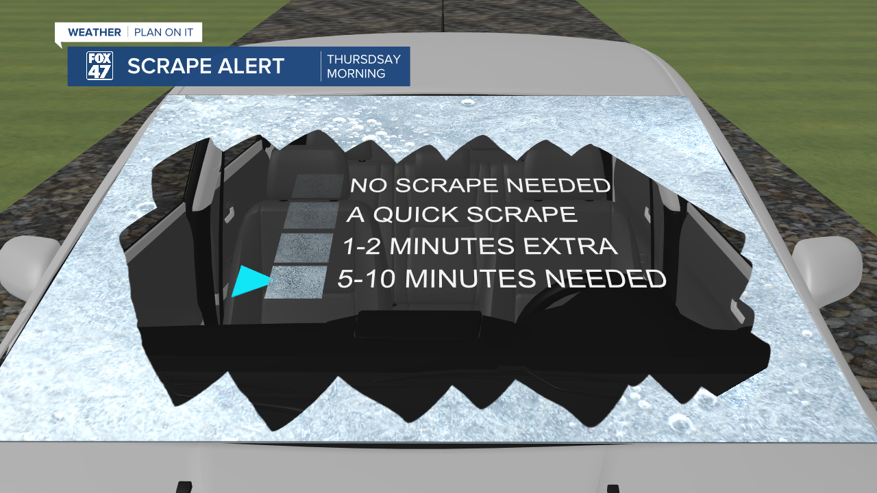
A Winter Weather Advisory is still in effect for all of our neighborhoods this morning. Clinton, Eaton, Ingham, and Jackson counties will be out of the advisory by 9 AM this morning. Hillsdale county advisory will expire at 10 AM this morning. Freezing rain and sleet have been observed throughout our neighborhoods this morning. We are expecting to see the end of wintry mix precipitation this morning, leaving icy road conditions for the morning commute.

Due to this ice, cars left outside overnight will have a layer of ice that will need a bit longer time to defrost or scrape off. Leave extra time when heading out the door this morning and stay weather aware when driving on icy roads. Road crew have been seen across our neighborhoods this morning as we are tracking our temperatures above 20 degrees. We are expecting to see temperatures rise above freezing today allowing for the wintry precipitation to melt as the roads are being treated. We could see some refreezing overnight of leftover wet spots that could create slick spots for the Friday morning commute.

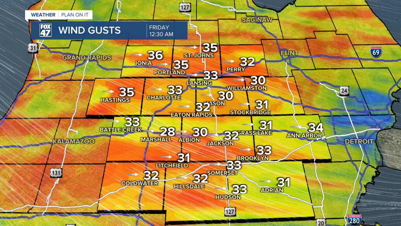
Once the afternoon comes, we will see our temperatures rise to the mid 30's with winds picking up on the back end of this low pressure system that drove the wintry mix. We could see wind gusts this afternoon meet or exceed 40 mph. These winds will calm a bit during the early evening hours and pick up again in the overnight hours as our wind direction begins to shift. If you have any light objects that could be affected by blustery conditions, make sure to bring it indoors for the day and overnight hours.
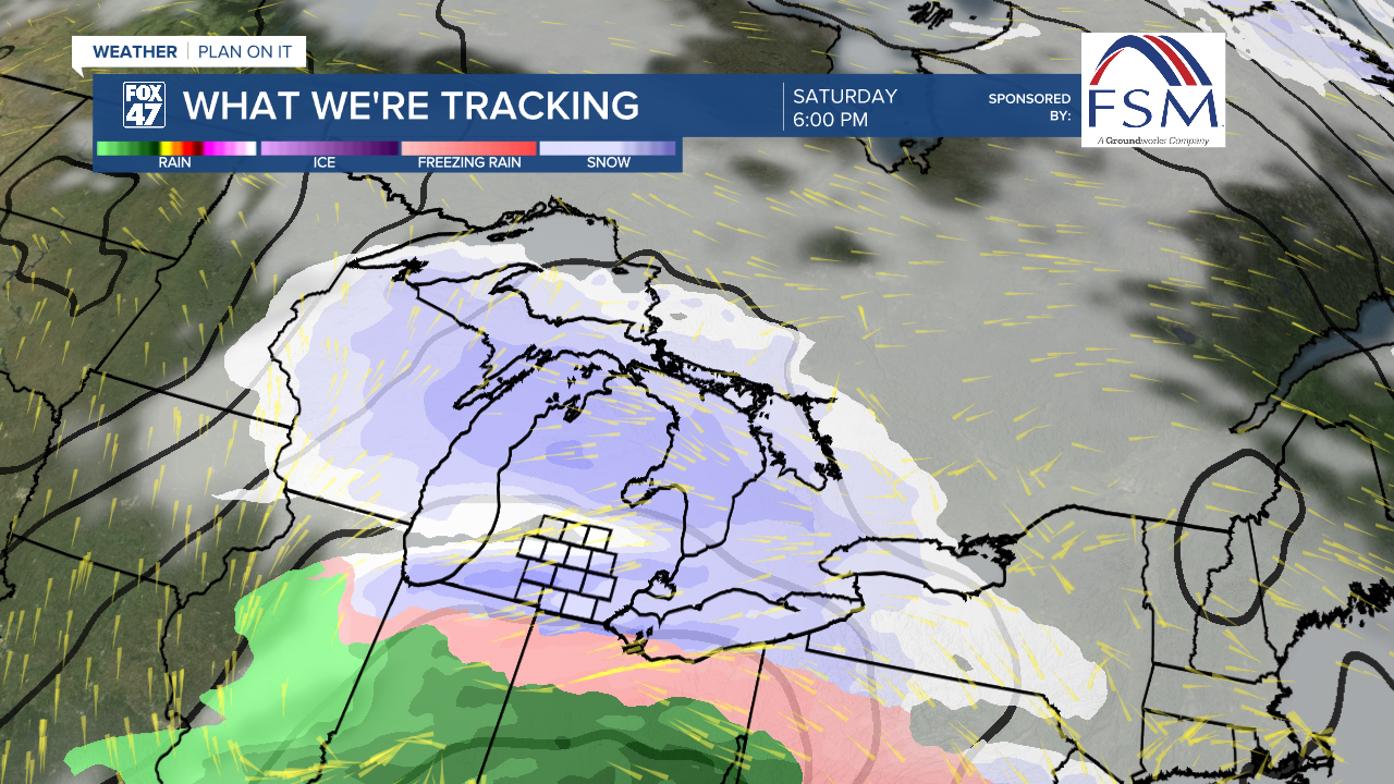
We are expecting to stay dry to end our work week on Friday, but precipitation won't stay away for too long. Saturday afternoon will see another system move into the Great Lakes region. Originally, we have been tracking a wintry mix event similar to today, however, latest trends favor accumulating snowfall for almost all of our neighborhoods with a chance for wintry mix along and south of I-94. Initial snow accumulations could range from 2-4" on Saturday. This is subject to change and we will continue to keep you updated.
Want to learn more about the Weather? Visit the FOX47News Website.
Stay in touch with us anytime, anywhere.
Sign up for newsletters emailed to your inbox.
Select from these options: Breaking News, Severe Weather, School Closings, Daily Headlines and Daily Forecasts.
