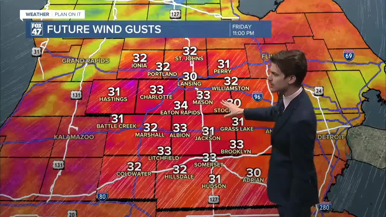
LANSING, Mich. — Spring is in full swing as of yesterday, but it's not feeling that way outside. We will warm today with highs in the lower 50's with winds out of the southwest, gusting near 40 mph.
These strong winds will continue through late evening tonight. We will see some calming in the overnight hours as our winds shift out of the north, allowing for a cool down.

We are also tracking multiple rounds of precipitation. Light rain is expected to move through our neighborhoods this evening. Showers should arrive at around 9 PM this evening with a second batch arriving past midnight. These showers don't look to pack a punch or bring any major impacts.
As we cool our temperatures, rain is expected to mix into snow by the time we reach Saturday morning. We are not tracking any major impacts or heavy snow accumulations affiliated with this system. We will have another round of rain and snow move through Sunday evening into Monday morning which also is not packing much of a punch right now, but we will continue to monitor as we get closer to next week.

We are also looking ahead at the rest of March and even though we are now in the spring season, we will be favoring cooler than average temperatures for the rest of our 7-Day as well as the majority of the remainder of this month.

Want to learn more about the Weather? Visit the FOX47News Website.
Stay in touch with us anytime, anywhere.
Sign up for newsletters emailed to your inbox.
Select from these options: Breaking News, Severe Weather, School Closings, Daily Headlines and Daily Forecasts.
