
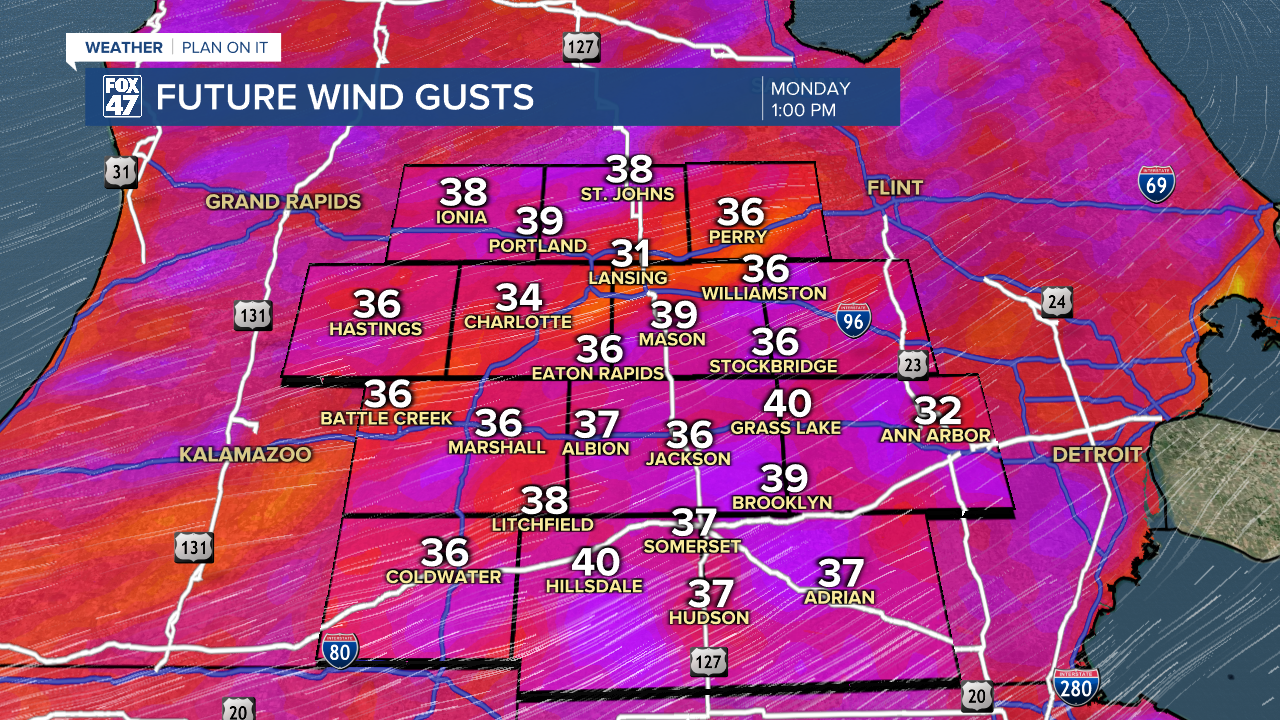
LANSING, Mich. — The National Weather Service has issued a Wind Advisory for Clinton, Ingham, and Eaton counties. This advisory is in effect now through 10 PM Monday evening. Strong southwest winds at 20 - 30 mph will allow for 40 mph gusts that could blow around unsecured objects this afternoon. Make sure to bring in any items that could blow away for the day.

An upper level shortwave and surface low pressure system brings showers and tame thunderstorms to our neighborhoods this morning. Showers continue through the late morning hours ahead of an incoming cold front.
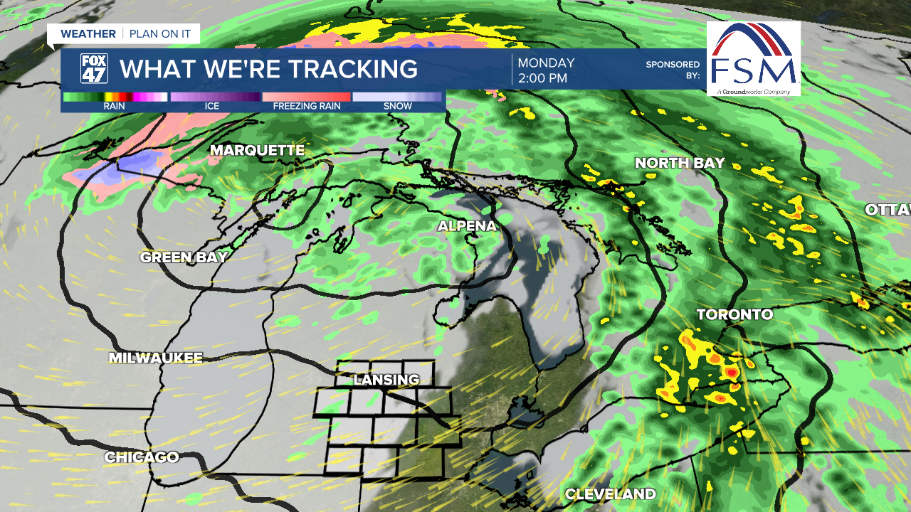
We will see our high temperatures exceed 60 degrees by noon as we will gradually cool this afternoon behind the cold front. Cloudy skies and breezy conditions will be left for the remainder of the day.
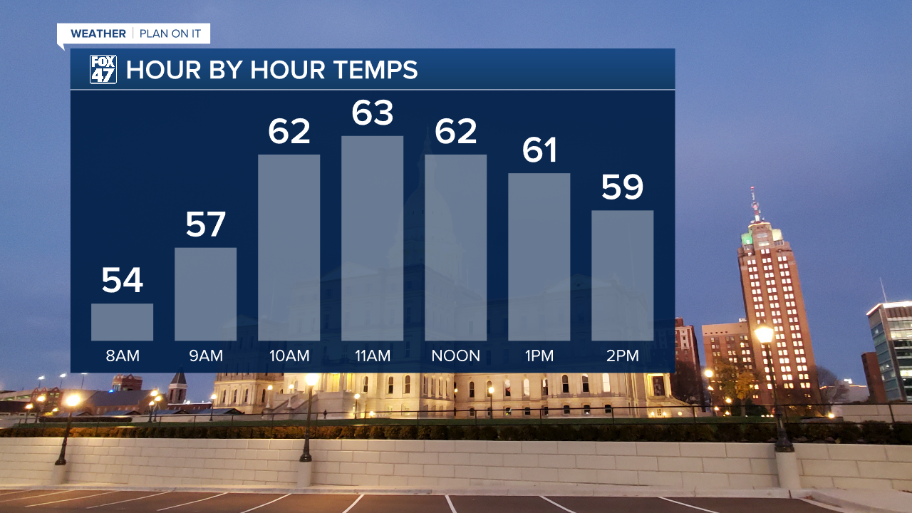
Clouds will fill in at around 10 AM this morning with winds picking up into the afternoon hours. We could see our max wind gusts near or meet 40 mph this afternoon out of the southwest, turning westerly heading into the evening hours.
We will dry up as surface high pressure takes over the state of Michigan. We will see increasing clouds throughout the day on Tuesday as we stay dry with relative humidity values in the upper 30% range Tuesday afternoon.
Another warm front will approach our neighborhoods beginning late overnight Tuesday into Wednesday. These showers are not looking to bring many impacts as they could last throughout the day. We will have a returning chance for showers to end the week on Friday.

Want to learn more about the Weather? Visit the FOX47News Website.
Stay in touch with us anytime, anywhere.
Sign up for newsletters emailed to your inbox.
Select from these options: Breaking News, Severe Weather, School Closings, Daily Headlines and Daily Forecasts.
