
LANSING, Mich. — Periods of rain will continue through this evening ahead of a cold front sweeping in from the Upper Midwest. Temperatures that climbed to the upper 40s to around 50 in some neighborhoods will slip back to the mid 30s around midnight when the cold front passes through our neighborhoods. This will also trigger a brief mix of rain and snow showers, changing completely to lake effect snow showers overnight as cold air pours back in across the region.
With temperatures quickly falling below freezing, we are at risk of experiencing a flash freeze by morning. Wet surfaces will likely become icy, especially if left untreated, and snow showers will only serve to make conditions more slick. Use caution when heading out in the morning, and be ready to layer up again! Strong winds pivoting toward the WNW at 15-20 mph will push winds chills close to zero in many neighborhoods as we head out the door Friday morning.

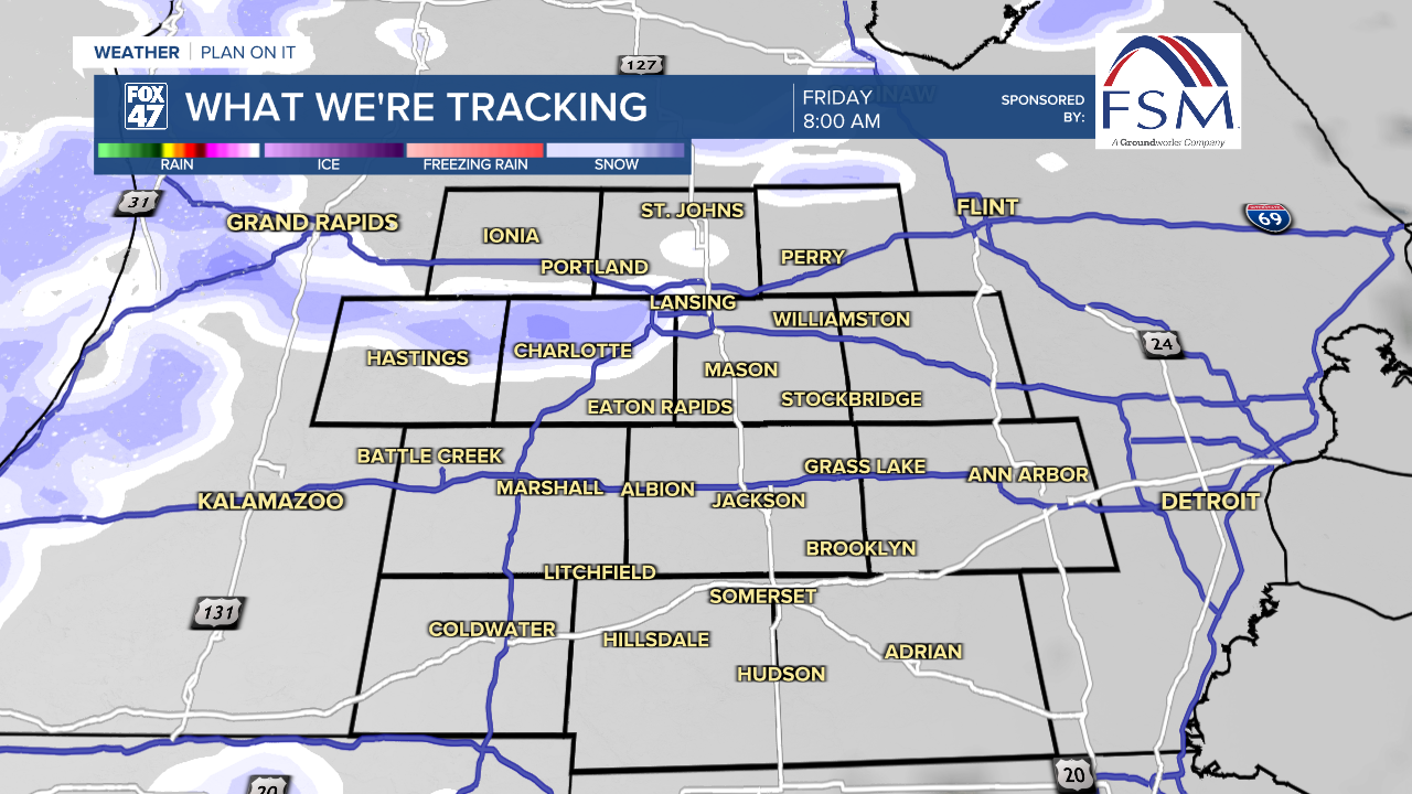
Friday is going to be a real crash back to reality. Following the bitterly cold and potentially icy conditions in the morning, winds will keep howling throughout the day. Scattered lake effect snow showers will continue throughout the morning before gradually tapering off in the afternoon.

Significant snow accumulation is not expected, but any snow showers will be enough to keep roads slick where they occur. Winds will increase to 20-25 mph for most of the day, with gusts approaching 40 mph at times. Stay alert for rapid changes in visibility, keep a tight grip on your steering wheel, and dress warmly. Highs will only return to the mid 20s, with wind chill hovering in the single-digits.
Looking ahead, we settle into a more variable weather pattern. Following Friday's cold conditions, we warm back into the upper 30s on Saturday as a small disturbance tracks through the Great Lakes. A few rain and snow showers will be possible, with mostly cloudy skies.
GET YOUR FOX 47 FORECAST HERE
Winter arrives at 10:03 AM on Sunday, and our weather flips cold again. We'll get a break from any rain or snow showers, with mostly cloudy skies and highs back to the mid 20s. Dry weather continues on Monday with more clouds, but we bounce back to highs in the mid 30s. Temperatures will continue to warm on Tuesday with another small disturbance rolling in. This one just brings rain showers, with highs on track for the low 40s.
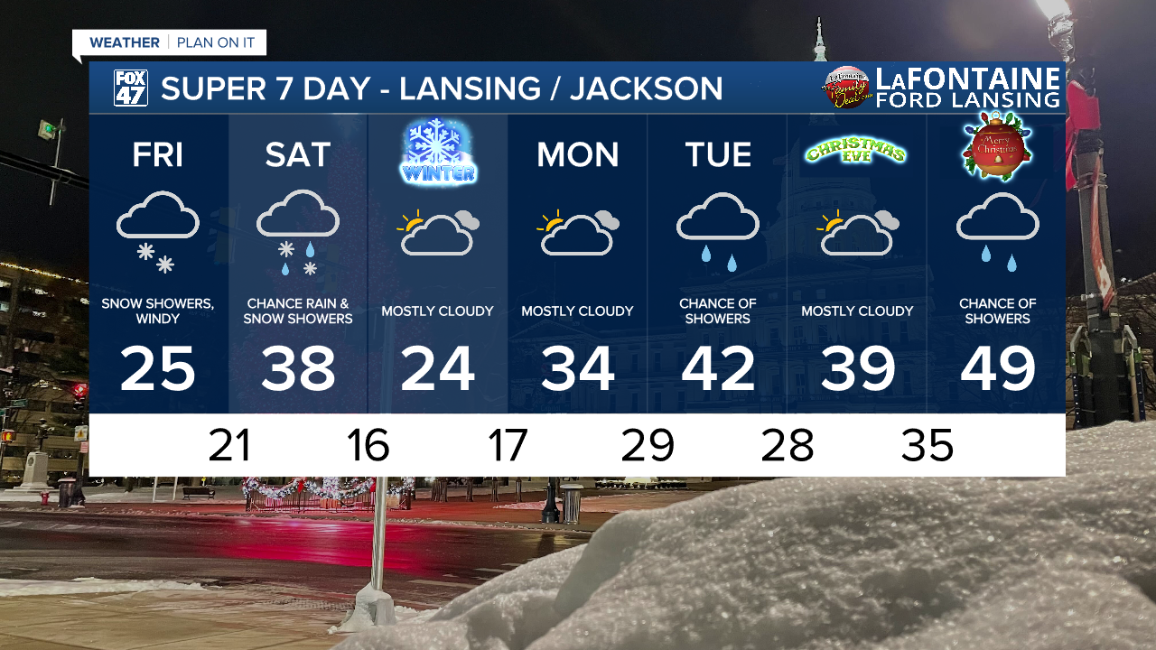
Taking an early look at Christmas, it's not looking good for our chances to get some snow back on the ground in time for the holiday. Christmas Eve is looking dry with mostly cloudy skies and highs in the upper 30s. Then, we take a jump closer to 50 on Christmas Day, but it may be coming along with a bit of rain.
Want more FOX 47 News? Here's how you download our Roku app
You can also see the latest news from across our mid-Michigan neighborhoods by liking us on Facebook or following us on X.
