
LANSING, Mich. — 10:00 AM UPDATE:
National Weather Service has issued a Wind Advisory for all of our neighborhoods except for Hillsdale County. We could see strong winds out of the southwest gust up to 45 mph into the afternoon hours. This advisory is set to expire at 3 PM this afternoon.
The cold front will advance in the early afternoon hours, leaving breezy conditions in excess of 30 mph gusts out of the northwest. This will allow us to gradually cool throughout the afternoon and evening hours.

ORIGINAL POST:
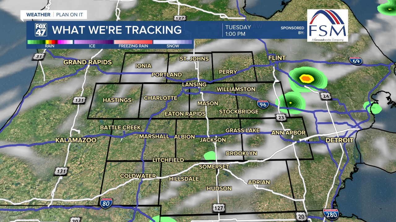
The showers and storms located over Wisconsin from Monday evening has made their way into the northern lower peninsula this morning. The line of storms has been weakening as we have been losing heating from the sun, however, weak instability is still present now that the warm front has passed through.
High temperatures today will stay in the mid 70's as we have already observed 70 degree temperatures this morning with strong winds out of the south. This trend will continue throughout the morning as we await the slow moving cold front, which will arrive in the early afternoon hours.
It is this same time where we could see some more scattered storms pop up as we gain more instability. No major changes were made this morning to the severe weather outlook. Hillsdale County, portions of Jackson County, and portions of Ingham County are under a slight risk for severe weather while Eaton and Clinton counties are under a marginal risk. Main impacts still look to be damaging winds and hail.
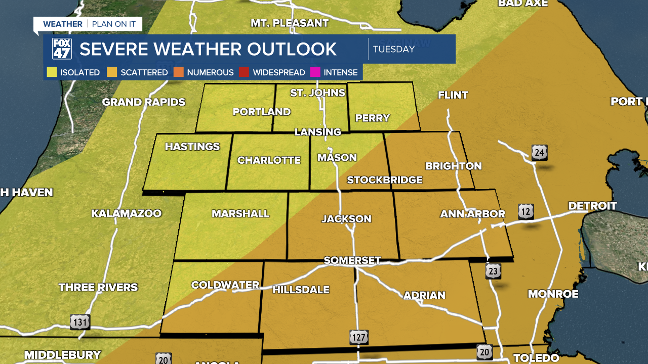
There is still some uncertainty as to the timing of these storms as it all depends on when the cold front moves through the area. Trends have shown that the early afternoon hours at around 1 PM, we could see some stronger isolated storms kick off. On the other hand, we could see the line of storms develop further east. Make sure to pay attention to the forecast today and know how to get your alerts.
Strong winds out of the south will gust up to 40 mph this afternoon before turning out of the north after the cold front advances. This will lead to a gradual cool down throughout the afternoon and evening hours. Our skies will be clearing as well once we head into the evening and overnight hours. With overnight lows dipping into the mid to upper 30's, frost is possible in our neighborhoods. If you have any plants, make sure to cover them up tonight.

We will have more showers arrive as early as Wednesday evening ahead of our next warm front. This will lead into a soggy Thursday with multiple rounds of showers and thunder in both the morning and afternoon hours. There is a marginal risk for excessive rainfall and we could see some flooding and ponding potential.

Want to learn more about the Weather? Visit the FOX47News Website.
Stay in touch with us anytime, anywhere.
Sign up for newsletters emailed to your inbox.
Select from these options: Breaking News, Severe Weather, School Closings, Daily Headlines and Daily Forecasts.
