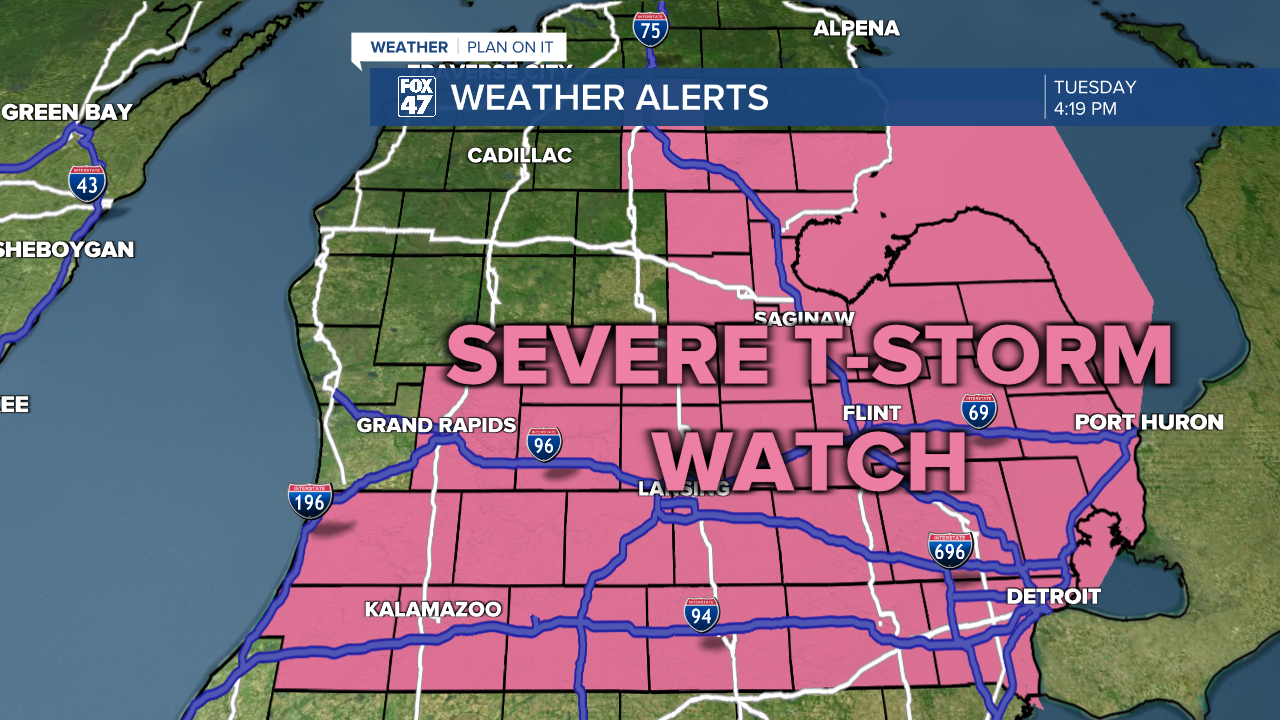
A Severe Thunderstorm Watch has been issued for Clinton, Eaton, Ingham, and Jackson Counties this afternoon as well as several counties to the east of us in the State of Michigan. This watch is currently in effect through 8 PM this evening as we are tracking thunderstorms to develop.
Main impacts to watch out for here this evening look to be scattered damaging winds and isolated large hail up to an inch and a half in diameter. We cannot rule out a possible tornado in the state of Michigan either this afternoon/evening.
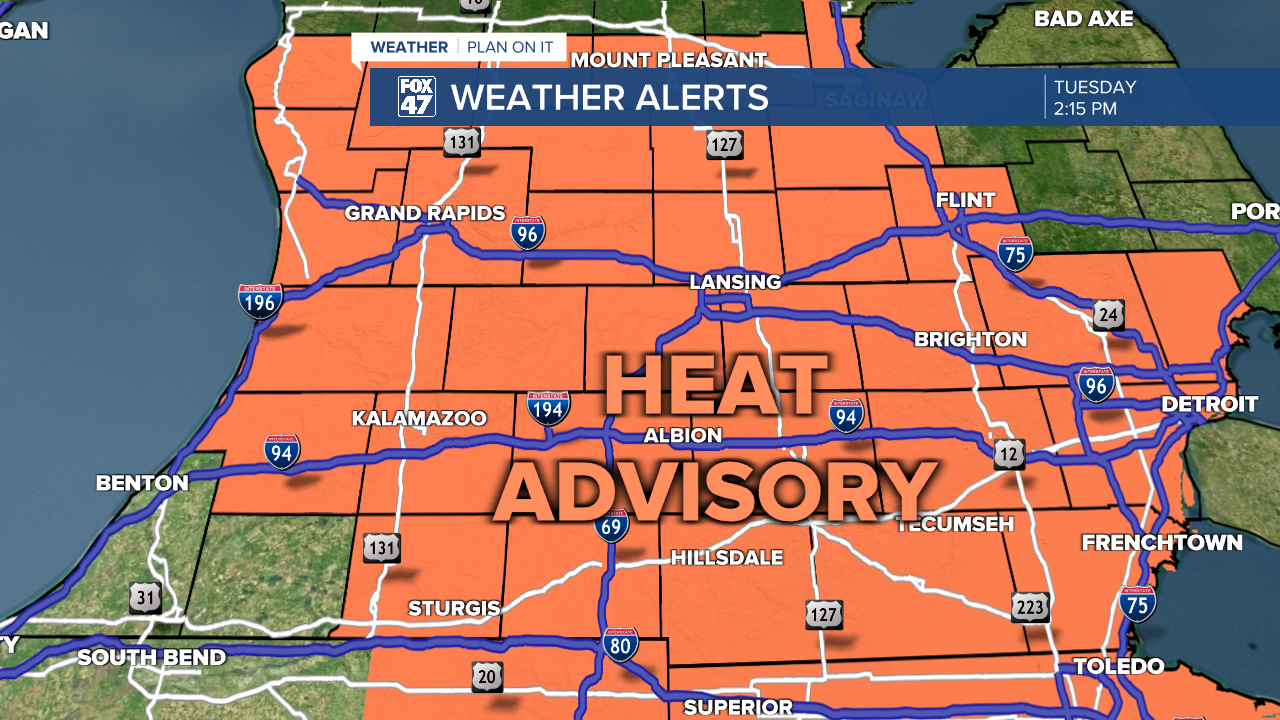
The warm moist air that we are dealing with today will aid in these storms as we still are under a heat advisory with air temperatures expected to max out in the 90's today with heat indices in the triple digits. This heat advisory is in effect through 10 PM this evening as we will be dealing with peak heat and storms this afternoon into the evening.
Watch below on how to stay safe during extreme heat and thunderstorms. Make sure you stay weather aware and know where your safe spaces are.
Want to learn more about the Weather? Visit the FOX47News Website.
Stay in touch with us anytime, anywhere.
Sign up for newsletters emailed to your inbox.
Select from these options: Breaking News, Severe Weather, School Closings, Daily Headlines and Daily Forecasts.
