
LANSING, Mich. — Temperatures in our neighborhoods met or exceeded 80 on Thursday. In some neighborhoods, we were near record heat. To close our work week, temps will cool a bit, but stay seasonably warm. Highs are trending in the mid to lower 70's as a surface low advances through the area today with showers and thunderstorms arriving Friday afternoon.
The low pressure system stalled out yesterday along the I-96 corridor and this morning is located right along the Michigan/Indiana/Ohio border. An upper level shortwave will aid in advancing this system through the forecast area today. This will allow for shower and storm development beginning at around 2 PM.
Temperatures will warm into the lower 70's with dew points in the lower 60's. It might feel a bit muggy outside today because of this. Thunderstorms look to stay tame due to the lack of ample wind shear. However, an isolated stronger storm could make its way through due to the gaining instability throughout the day. Main impacts include gusty winds in excess of 30 mph and heavy rainfall rates. Showers and storms should exit our neighborhoods at around 8 PM.

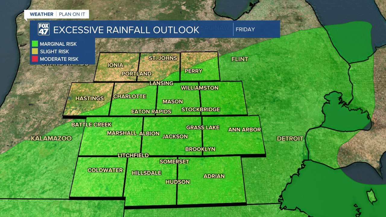
There is a marginal risk for excessive rainfall in Hillsdale, Jackson, Ingham, and portions of Eaton and Clinton counties. These areas could see some localized flooding and ponding. Stay weather aware when heading out the door today. Remember to turn around and don't drown if roads are in flood conditions.
Winds will turn out of the north tomorrow with gusts nearing 30 mph. This will help transfer cooler air into our neighborhoods to start our weekend. We are seeing high temperature trends in the mid 50's.

We will continue to warm as we enter a new work week. Tuesday, highs will range in the mid to upper 70's with a chance for severe thunderstorms with all impacts possible. We could still see some changes to the evolution of this upcoming system and we will be watching it very closely. Make sure to have a plan for if and when severe weather strikes.

Want to learn more about the Weather? Visit the FOX47News Website.
Stay in touch with us anytime, anywhere.
Sign up for newsletters emailed to your inbox.
Select from these options: Breaking News, Severe Weather, School Closings, Daily Headlines and Daily Forecasts.
