
LANSING, Mich. — Many of our neighborhoods hit the 80-degree mark for the first time this year on Thursday, and we're going to keep the pleasant weather going throughout the evening. Clouds will gradually increase, with temperatures gradually cooling through the 70s before midnight.
A stray shower or thunderstorm will become possible closer to daybreak as a more unstable air mass begins to move in from the south. Lows will remain mild once again, dipping to the low 50s.
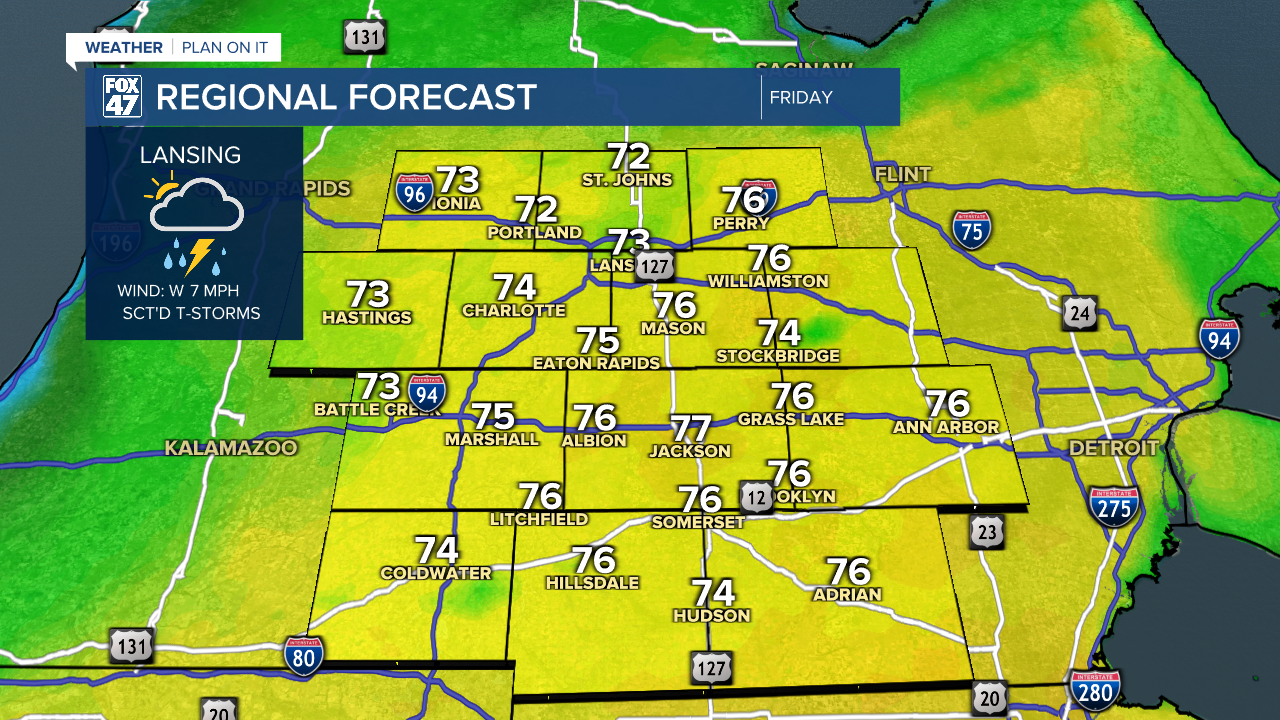
An area of low pressure moving out of the central United States will head for the Great Lakes on Friday, strengthening a bit as it does. This will lead to mostly cloudy skies throughout the day, with scattered showers and thunderstorms flaring up during the afternoon. Severe weather is not expected, but storms could still produce heavy downpours, gusty winds, and frequent lightning. Highs will remain warm on Friday, but we'll scale back to the low and mid 70s for highs.

A few leftover showers may linger until about midnight on Friday night, but will taper off for the overnight hours. Cloudy skies will remain in place for the time being, with lows taking a chillier turn back to the low 40s.

The will leave us with a cooler, but still pleasant weekend, especially when we factor in plentiful Spring sunshine. After some lingering clouds on Saturday morning, will break into sunnier skies for the afternoon and then carry that into Sunday. Highs will be held to the mid 50s to start the weekend, but we'll get back to the mid 60s on Sunday.
Want to learn more about the Weather? Visit the FOX47News Website.
Stay in touch with us anytime, anywhere.
Sign up for newsletters emailed to your inbox.
Select from these options: Breaking News, Severe Weather, School Closings, Daily Headlines and Daily Forecasts.
