
LANSING, Mich. — Yesterday high temperatures in our neighborhoods were allowed to reach the mid 50's due to an abundance of sunshine. We will continue to see the sunshine today in intervals as we favor partly cloudy skies. Temperatures are continuing to flirt with 50 degrees for daytime highs Wednesday.
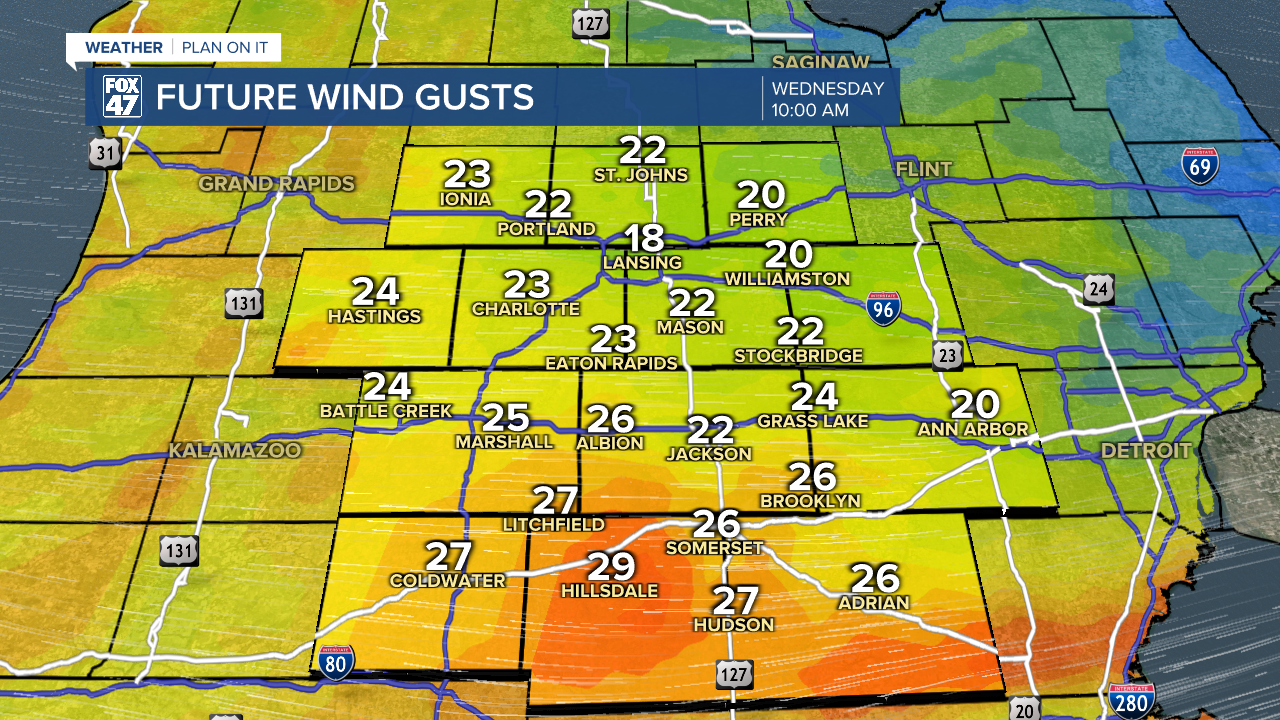
An advancing mid level trough will drive some stronger winds this morning, especially in our southern neighborhoods. In Hillsdale County, gusts are nearing 30 mph through about noon. Neighborhoods to the north are looking at winds gusting from 20 to 25 mph for the first half of Wednesday. These winds will continue to die down through the afternoon as that trough moves out of the area.
Tomorrow, temperatures will begin to warm again with high temperatures back into the mid 50's. We are still looking to stay dry on Thursday with partly cloudy skies. As strong low pressure begins to track towards the Great Lakes region, temperatures will range in the upper 60's and possibly flirt with 70 on both Friday and Saturday. This will also bring our next batch of rain showers and even a possible thunderstorm.
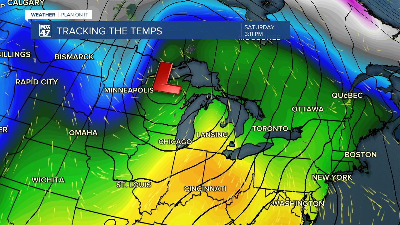
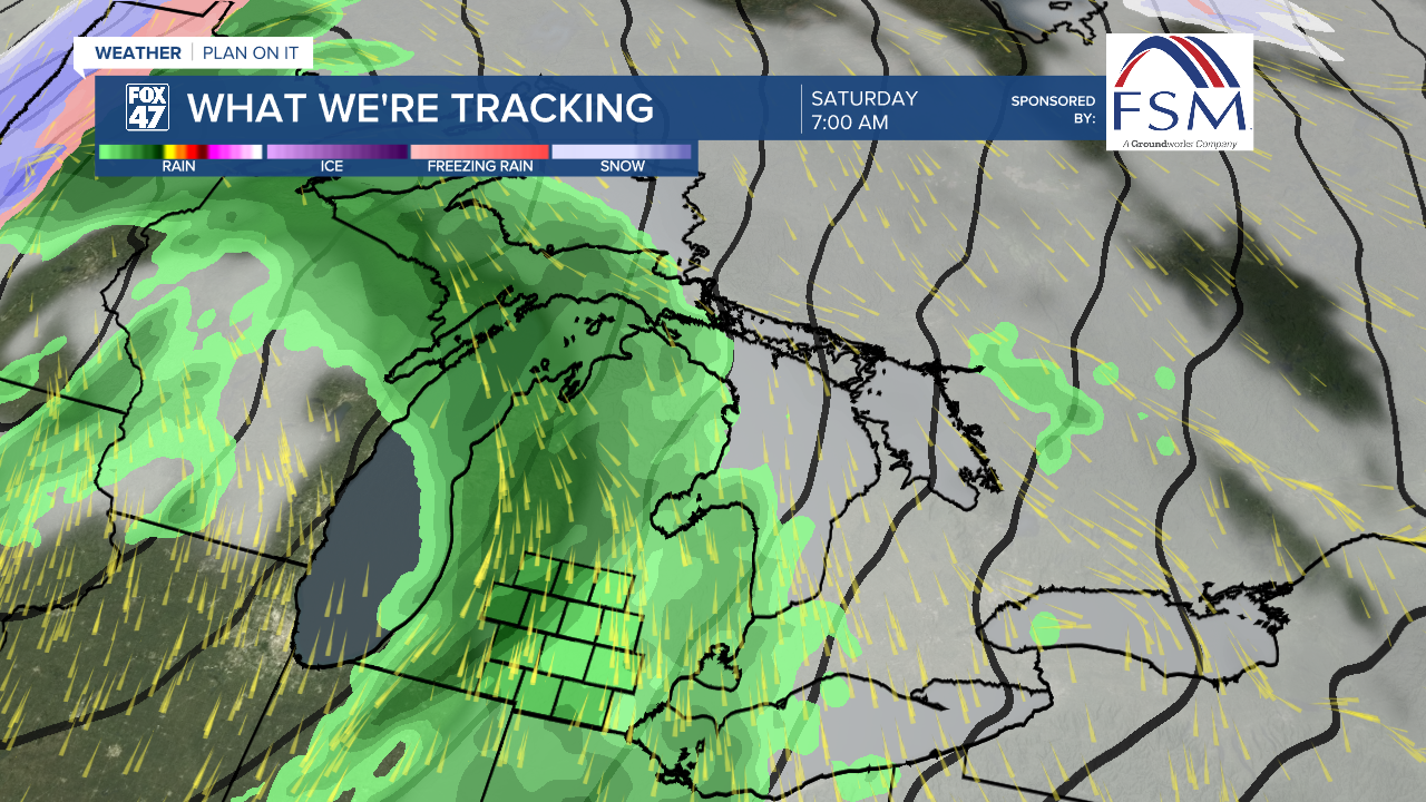
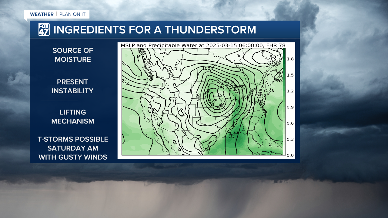
Showers are looking to begin at around 3 AM on Saturday morning ahead of the cold front. The main round of uniform showers is looking to track through during the 7 AM hour on Saturday where we could see potential thunderstorm development as ample moisture and ascent from the strong low level jet will be present. The mitigating factor remains with the lack of instability in our atmosphere given the timing of these storms.
As of now, possible impacts to watch out for with this Saturday morning round includes gusty winds and periods of heavy rain with a chance for T-Storms. We will continue to track the evolution of this strong low as we progress through the week.
Shower chances continue into Sunday morning as we cool down on Sunday with high temperatures in the lower 40's. We are looking to warm up again by the time we start next week with highs flirting with 50 degrees on St. Patrick's Day on Monday.
Want to learn more about the Weather? Visit the FOX47News Website.
Stay in touch with us anytime, anywhere.
Sign up for newsletters emailed to your inbox.
Select from these options: Breaking News, Severe Weather, School Closings, Daily Headlines and Daily Forecasts.
